Splatter Spotter Overview

The United States has 6.5 million kilometers of public roads that are used by approximately 255 million vehicles annually. Road corridors cover approximately 1% of the surface of the United States, but the ecological impacts extend well beyond these actual road surfaces. A minimum of 19% of the terrestrial United States is directly affected by roads, and 22% of the United States appears to be ecologically altered by our road network. Roads alter species interactions, animal behavior, soil characteristics, hydrology, and vegetative cover. The magnitude of these effects is correlated with proximity to the road surface, but extends throughout a “road effect zone”. This app is designed to allow you to help scientists track where road kill is the most common, allowing us to better design roads and crossing structures to minimize the harm to animals and the hazards to drivers.
App Features
Mode Choice Screen
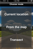
You have a choice for sampling road kill. You can either mark the location where you currently are (“Current location” button), mark a location you saw on your drive via a map interface (“From the map” button), or mark multiple kills (or lack thereof) while you drive somewhere (“Transect”) button.
Transect Start-Up Screen
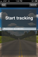
Accidents here refers to previous observed kills. You can keep cycling back to this screen until you reach your destination and end your transect.
From the Map Start-Up Screen
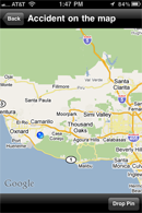
Here you hit the “Drop Pin” button and then drag the resulting pin to the location where you had previously observed a road kill.
Species Screen
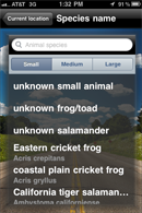
This is where you identify the critter. It is based upon size: small (a loaf of bread or smaller), medium (loaf of bread to dog sized), or large (bigger than a dog size). Within each size category are specific species, general groups (unknown frog/toad) and unknown animals (e.g. unknown small). You can enter them by taping on the name or typing in the text box. Both common names and Latin names are recognized.
Choose Photo Screen
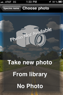
This is where you can either take of photo of the kill or attach a photo of the kill taken earlier. These will be sent along with the final report. Alternatively you can not use a photo at all.
Road Information Screen
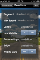
This screen is where you can add additional information that can help us interpret your data. But it is also fine to simply leave these options undefined.
Additional Information Screen
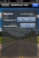
Again, some supplemental data that helps us interpret your results.
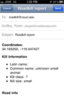
Road Kill Report Screen
If you are doing a transect you have the option to continue logging additional kills. When you are done with that (or after you have entered your single kill via the Current Location Mode or From the Map Mode), you can hit the send button which ports your data over to your e-mail. All you have to do is hit send and you will send an e-mail with the relevant data to our server as CSU Channel Islands. Simple!